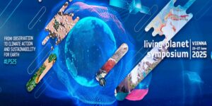
Living Planet Symposium 2025
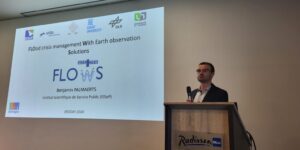
23-27 June 2025 Several members of the FLOWS team took part in the Living Planet Symposium 2025, held in Vienna. Organized by ESA, this major conference is dedicated to Earth …
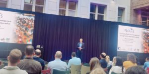
How Can Earth Observation Improve Flood Response?
The Institut Scientifique de Service Public (ISSeP) is a public research body under the authority of the Walloon Government, with a mission to support environmental monitoring and risk assessment. As Wallonia’s reference laboratory, ISSeP provides scientific expertise and technical support to regional authorities, cities, and private companies, operating key monitoring networks for air, water, soil, and radiation. Through its work, ISSeP helps ensure reliable data for informed environmental policy and decision-making. The Remote Sensing and Geodata Unit works on the development of innovative and operational Earth observation and Geographic Information System (GIS) services. It specialises in land cover and land use mapping, population distribution modelling, urbanisation dynamics and environmental and health risk management. In addition to be the coordinator of FLOWS, ISSeP also works on the development of the flood-induced damage assessment model.
VITO is a leading European independent research organisation, conducting customer-oriented research in the areas of cleantech and sustainable development, for both the public and private sector. VITO’s Remote Sensing unit has expertise in addressing and translating remote sensing user needs in an operational manner, exploiting both airborne and spaceborne sensors. Application domains include agriculture, biodiversity, water, coast, security and climate. Moreover, it has a rich experience in data (pre-)processing, archiving and image classification on both the local and global scale. In the FLOWS project, VITO brings its expertise in EO and UAV processing to increase situational awareness during a flood crisis.
The National Geographic Institute (NGI-IGN) is the federal-level manager of geodata and acts as a geobroker. NGI collects, manages, and distributes geographic information about Belgium in the form of maps, aerial photographs, and digital geodata. The Direction of the Strategy at the NGI is in charge of supporting Belgian federal administration making use of cartography. In particular, it works with emergency services, Defence, the National Crisis Centre or the newly created Climate Risk Assessment Centre (CERAC) to develop cartographic tools and empower those administrations in the field of geomatics. Within the FLOWS framework, NGI makes the link between the EO and AI researchers and all the services involved in flood response.
The University of Ghent and its IDLab research group conducts fundamental and applied research in the domain of AI and Connectivity. IDLab collaborates with many universities and research centres worldwide and jointly develops advanced technologies with industry. Within this group, the Distributed Machine Learning group (DML) performs research into machine learning algorithms for high-dimensional sensor processing and motor control of edge devices (smartwatches, robots, surveillance cameras). The group has transferred its knowledge to applications in smart agriculture, Industry 4.0, healthcare robotics and now Earth observation for the FLOWS project.
The German Aerospace Center (DLR) is Germany’s national research center for aeronautics and space. Within DLR, the Earth Observation Center (EOC) includes two institutes involves in FLOWS: the Remote Sensing Technology Institute (IMF), which develops advanced AI algorithms for processing large-scale remote sensing data, and the Georisks and Civil Security department, which supports disaster management through satellite-based geoinformation. This department also operates the Center for Satellite Based Crisis Information (ZKI), providing rapid satellite-derived data during crises. In the project, DLR produces maps for crisis stakeholders by combining geodata from various sources. Additionally, DLR brings external data and perspective on the 2021 floods, which heavily affected Germany.
The Department of Geography of the University of Namur is involved in FLOWS as a subcontractor, for their expertise in population modeling. UNamur will produce population distribution maps weighted to represent vulnerable population groups during the July 2021 floods in Belgium and an GIS-based analytical protocol to assess, in near real-time, the spatiotemporal variations in population distribution and movement.
23-27 June 2025 Several members of the FLOWS team took part in the Living Planet Symposium 2025, held in Vienna. Organized by ESA, this major conference is dedicated to Earth …
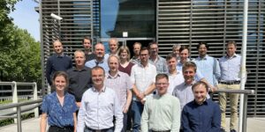
14 May 2025 The FLOWS Steering Committee held its inaugural meeting with a full-day session at the NGI premises in Brussels. This committee brings together leading scientific experts in Earth …
14-05-2024 : The Belgian Earth Observation Day (BEODay), organized by BELSPO in Hasselt, brought together the Belgian EO community. All projects selected under the STEREO IV programme in 2023 were showcased, including FLOWS! This was a nice opportunity for this newly launched project to get known by the EO community.
22-05-2024 : The FLOWS project was presented at the AI4Copernicus 2024 conference held at the premises of the Netherlands Space Office (NSO) in the Hague.
16-09-2024 : All partners of the FLOWS consortium spent one day at ISSeP discussing the first scientific developments of the project, in line with the stakeholders’ needs already identified.
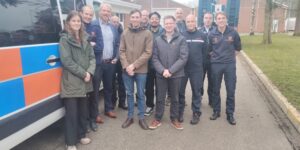
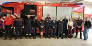
20-01-2025 : The FLOWS partners met drone operators of the Belgian Civil Protection in Braaschaat.
19-02-2025 : The FLOWS coordinator was invited by the Nederlands Institute for Public Safety (NIPV) to share a Walloon perspective on the 2021 floods and to present the FLOWS project during a meeting held in Valkenburg, Netherlands.